The Future of 3D Laser Scanning in Australian Land Surveying
Table Of Contents
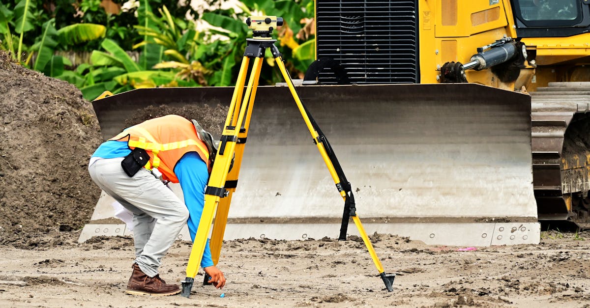
Comparing Traditional Surveying Methods with 3D Laser Scanning
Traditional surveying methods, while effective, often involve time-consuming processes and a reliance on manual measurements. Techniques such as total stations and theodolites require surveyors to physically measure distances and angles, which can lead to human error and inaccuracies. These methods are well-established and have been used for decades, but they may not deliver the level of detail and efficiency needed for modern projects.
In contrast, 3D laser scanning provides a rapid and precise way to capture spatial information. This technology allows for the collection of millions of data points within a short timeframe, creating a comprehensive and accurate representation of the surveyed area. The ability to generate detailed 3D models enhances analysis and planning. Laser scanning reduces the likelihood of errors and significantly decreases the time spent on site, leading to improved productivity for surveyors in Australia.
Evaluating Cost-Effectiveness and Precision
The integration of 3D laser scanning in surveying practices has transformed cost parameters significantly. Initially, the investment in advanced technology may appear substantial; however, over time, the savings in both time and labour can outweigh the initial outlay. By capturing vast amounts of data quickly and accurately, surveyors can reduce the time required for projects, leading to lower overall operational costs. Additionally, the ability to gather comprehensive datasets in a single survey reduces the need for multiple site visits, further decreasing expenses.
Precision remains a paramount consideration in surveying, and 3D laser scanning excels in this regard. The technology provides detailed point clouds that deliver exceptionally accurate measurements, minimising the potential for human error associated with traditional methods. As a result, projects benefit from enhanced reliability and fewer discrepancies during execution. This level of accuracy is particularly crucial in complex environments, where small errors can translate into significant issues, making 3D laser scanning a preferred choice for modern surveying needs.
Training and Skill Development for Surveyors
As the landscape of surveying evolves, it becomes imperative for professionals to acquire new skills aligned with advancements in technology. Familiarity with the latest 3D laser scanning equipment and software tools is essential. Training programs should focus not only on technical competencies but also on enhancing analytical abilities. A well-rounded education can prepare surveyors to tackle complex projects with greater accuracy and efficiency.
Investing in continuous professional development is crucial for surveyors aiming to stay relevant in an increasingly automated environment. Workshops, certifications, and hands-on training sessions play a significant role in equipping them with the necessary expertise. Partnerships between educational institutions and industry leaders can facilitate knowledge transfer and keep curricula updated. This collaborative approach ensures that surveyors are well-prepared to harness the full potential of emerging technologies in their work.
Preparing Professionals for Future Technologies
As the landscape of land surveying evolves, the need for professionals to adapt to technological advancements has never been more critical. Educational institutions are beginning to incorporate modern surveying techniques into their curricula, providing students with hands-on experience using 3D laser scanning technology. This shift prepares future land surveyors to confidently navigate their careers while harnessing cutting-edge tools that enhance measurement accuracy and efficiency.
Continuing professional development plays a vital role in ensuring that existing surveyors keep pace with emerging technologies. Workshops and training sessions focused on 3D laser scanning expand the skill sets of industry professionals, enabling them to leverage these tools effectively in their work. Industry partnerships with technology providers further facilitate access to state-of-the-art equipment and innovative practices, ensuring that surveyors remain competent in an increasingly competitive market.
Case Studies of Successful Implementations
In recent years, several Australian projects have demonstrated the advantages of 3D laser scanning technology in land surveying. One notable example includes its application in heritage conservation efforts, where detailed scans have helped document and restore historical sites. The accuracy of the scans allowed surveyors to create precise 3D models of complex structures, ensuring that restorations retained the original architectural integrity. Furthermore, these models facilitate ongoing maintenance and provide a valuable resource for future research and documentation.
Another significant implementation occurred during large infrastructure projects, such as the construction of new highways and bridges. By employing 3D laser scanning, project teams achieved efficient site measurements and mapping, reducing the time spent on traditional surveying methods. This technology enabled rapid identification of potential issues and discrepancies in design versus field conditions. The integration of such advanced surveying techniques not only improved project timelines but also contributed to better resource allocation and cost management, showcasing the tangible benefits of embracing modern surveying tools.
Real-World Examples in Australian Projects
The use of 3D laser scanning has found notable applications across various projects in Australia, particularly within urban development and infrastructure sectors. For instance, a significant undertaking involved the redevelopment of a historical site in Sydney, where surveyors utilised laser scanning to capture intricate architectural details. This technology allowed for precise documentation of the existing structures, reducing the time needed for traditional surveying methods and increasing overall accuracy throughout the design process.
In another example, during the construction of the Melbourne Metro Tunnel, 3D laser scanning played a vital role in monitoring progress and ensuring alignment with initial designs. The ability to create detailed point clouds of the construction site enabled teams to identify deviations and adjust strategies promptly. This real-time data facilitated better communication among project stakeholders, ultimately leading to more efficient project management and enhanced safety measures.
FAQS
What is 3D laser scanning in land surveying?
3D laser scanning is a technology that captures the physical dimensions of objects or environments by using laser beams to create a detailed 3D model, which can be used for analysis and planning in land surveying.
How does 3D laser scanning compare to traditional surveying methods?
3D laser scanning typically offers greater accuracy and efficiency than traditional methods. It can capture vast amounts of data in a shorter time, reducing the need for multiple site visits and manual measurements.
What are the cost implications of using 3D laser scanning?
While the initial investment in 3D laser scanning equipment may be higher than traditional surveying tools, the long-term savings in time and labour, as well as the increased precision, often make it a cost-effective choice.
What skills do surveyors need to effectively use 3D laser scanning technology?
Surveyors should have a strong understanding of 3D modelling software, data analysis, and familiarity with laser scanning equipment. Technical training and ongoing professional development are essential for effective implementation.
Can you provide examples of successful 3D laser scanning projects in Australia?
Yes, several Australian projects have successfully implemented 3D laser scanning, including infrastructure developments, heritage site documentation, and excavation projects, showcasing the technology's versatility and effectiveness in various contexts.
Related Links
Advanced Techniques in 3D Laser Scanning for Geospatial AnalysisHow 3D Laser Scanning Enhances Land Surveying Efficiency
Case Studies: Successful Implementations of 3D Laser Scanning
Cost-Benefit Analysis of Adopting 3D Laser Scanning in Surveys
Training and Skills Required for Effective 3D Laser Scanning
Integration of 3D Laser Scanning with Other Surveying Technologies
Comparing 3D Laser Scanning with Traditional Surveying Methods
The Advantages of 3D Laser Scanning for Accurate Land Measurement
Understanding the Fundamentals of 3D Laser Scanning in Surveying